
Downriver Beat
Archives
Metro Detroit Braces for Potential First Snowfall This Weekend
SIGN UP FOR OUR NEWSLETTER
Metro Detroit Braces for Potential First Snowfall This Weekend |
Colder temperatures and precipitation may bring light snow to the area |
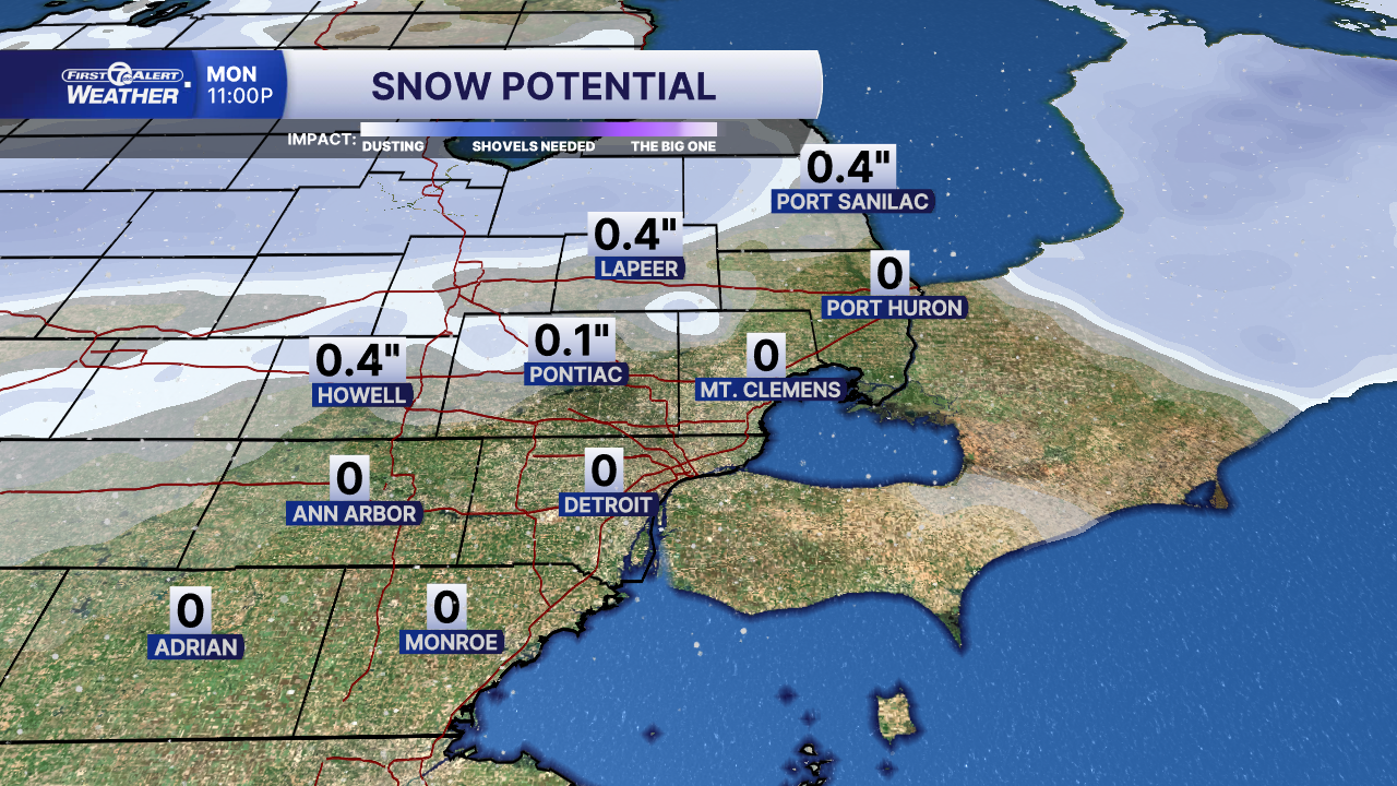 |
Residents of Metro Detroit should prepare for a potential shift in weather this weekend, as forecasts indicate a chance of the season's first snowfall.
A cold front is expected to move into the region, causing temperatures to drop significantly. Highs are projected to be in the mid-40s, with overnight lows dipping into the 20s and 30s. For instance, Sunday's forecast shows a daytime high of 42°F and a low around 27°F. This temperature decline, combined with incoming precipitation, sets the stage for possible snow showers.
Historically, Detroit's first measurable snowfall occurs around mid-November. The 30-year average snowfall for November is approximately 2.6 inches. Given the current forecast, any snowfall this weekend is expected to be light, with accumulations ranging from a dusting to perhaps 1 inch. However, localized areas could see slightly higher amounts if snow bands linger.
It's also possible that the precipitation remains as rain or a rain/sleet mix, resulting in minimal or no snow accumulation, especially if ground temperatures stay above freezing. Residents should be cautious, as wet roads combined with dropping temperatures Sunday night into Monday morning could lead to icy conditions during the Monday commute.
In summary, Metro Detroiters should anticipate colder weather with a moderate chance of light snow from Sunday into Monday. While significant accumulations are unlikely, this event may mark the first noticeable snowfall of the season. Ground conditions and temperatures will ultimately determine how much, if any, snow sticks. |